Kohalpur to Butwal, the long route!

This morning I had a breakfast of fruit, bread and cheese, most of which I had picked up from the market in Dhangadhi. I also bought some squeezed orange for 50 rupees (Less than a dollar). Juice bars seem popular here, so Nepal must be a fruit paradise.

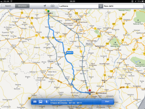
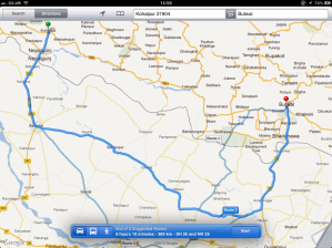
Plotting my route this morning presented a bit of a problem for me. The rule is that I can only travel along the route that Google maps gives me. If it suggests more than one route, I can choose any one of them, but I must stick to the routes given. Entering Kohalpur and Butwal on my iPad, Google maps takes me back into India, west along the SH26 and then back into Nepal on the NH29, taking about six hours. This is despite the H01 taking me to the same place, but a much shorter route. I checked along the Google Earth view and the roads seem fine, but Google maps doesn’t have the data to get me there. So, sticking to the rules, I take the road south back into India.

Not the route I would have taken.

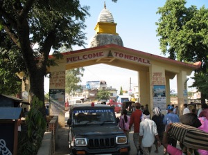
Surprisingly, few travellers use the border crossing at Nepalgunj, despite the fact that Lucknow is only four hours south. The main observation is that you get mobbed by traders and it is full of cheap hotels and contraband goods. The border crossing itself is trouble free and I am through in no time.

The SH26 takes me through well farmed land, with fields on either side of the road. It’s not uniform like you would find in Germany, just like the irregular farming in the UK, but the soil is more redder in colour.

Leaving India, again.

100 yards and into Nepal, again.

Is it me, or do the Nepalese do things with a little more style? I drive up and through Bhairahawa and pull over to top up the fuel tank at the Durga petrol station and buy more food at a stall across the road. I have never eaten so much fruit in my life, but it is readily available on every corner. Back on the Siddhartha highway, I head north towards Bulwal.

Oh, by the way, I found this great site for finding things in Nepal, including petrol stations. Alas, it seems a little Kathmandu-centric, if you are looking for a hotel, but otherwise useful. I ‘booked’ a room for the night in Hotel Sindoor, which had ample parking and the motto: To satisfy our honourable guest. Can’t go wrong, really.

Posted in Enroute | Tagged , , , | Leave a comment

Crossing the Karnali river

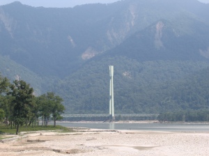
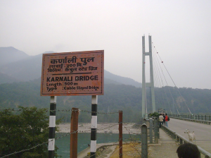
Hustled in the hamlets and forests along the H01 highway, it is not until I get the Chisapani bridge that I get my first real view of the Mountains to the north. The bridge is a landmark in the area, and was completed in 1993, this is the only cable-styled bridge in Nepal and one of the longest of its kind in the world. It is 500m (1640 ft) long, 10 m (33 ft) wide and 125m (410 ft) high. Before the bridge was built by Kawasaki Heavy Industries of Japan, the river was crossed by boats and ferries, which was fatal in some cases during the monsoon floods.

Spectacular view of the mountains.

Engineering at its best.

Before the highway was completed in the 1980′s, the only acces to Chisapani was a five or six day elephant ride through the Bardiya forests, or by foot. The Karnali river, the longest in Nepal, starts out on Mount Kailash and Lake Mansarover in Western Tibet.

Posted in Enroute | Tagged , , , , | Leave a comment

Day 28: Dhangadhi

Dhangadhi is close to one of the border crossings to India and has a population of around 68,000. I found out that there is an open border between Nepal and India, much the same as we have in the Eurozone, although I suspect it is a little more relaxed here. It is well connected to other cities in Nepal, has it’s own airport and is the main trading city in the Seti region. One of the things I notice most in Nepal is the style of property is very different to India. The Nepalese are not afraid to use colour, and red and ochre seem to be the main choices. It certainly adds a welcome touch to the villages and towns.

A view of a main street.

A colourful, inviting city.

Kathmandu is about 660 km (410 m) to the west and certainly a future destination in the coming days. I visit the market street and pick up some fruit that I can snack on as I drive. There is a definite lack of cars or trucks, and the biggest form of transport is the humble bike, although an awful lot of people just walk. Although the roads are in pretty good condition, stepping up onto the pavement is not always straight forward, as they are not really maintained. Most of the shops have a porch of some kind and the shop fronts are open to all.

There is a wonderful difference in facial features between the Indian and Nepalese people. It always fascinates me that we can all be on the same planet, but our environment or breeding can generate such differences. We are animals, after all. As I head out of the city, places get a little less defined and housing seems less prosperous. I have a four hour trip to Kohalpur for my next stop off, which is back up along the H01 highway and along the side of the Bardiya National Park.

Posted in Places | Tagged | Leave a comment

Head for the hills

The NH125 road towards Banbasa was lined with trees and the road was in good condition. When I arrived at Banbasa I am directed right onto the H01 that leads toward the Nepalese border and I pass the train station and along a straight road, which then follows a wide river along to a dam wall. I am not stopped by the Police and am allowed to drive through. They didn’t seem to be so interested in stopping everyone.

Right after Banbasa

This is one very straight road.

At this stage the road becomes narrower and I drive through a hamlet of small cottages. This is Gadda Chauki. I am then stopped by Police in blue uniforms. These are Nepalese officials. They check my passport and ask me to fill in a form, which is almost entirely in Hindi. I am given a sheet of paper with some English translations on and I fill in the form as best I can. There is a fee to pay, and I hold out my money and the officer takes quite a bit. Not entirely sure that I haven’t just been robbed, but I don’t think I should argue. There is then something called Traffic permission, which seems to be a road tax or permit to travel. I hand out more money. I must have done an OK job, because they waive me on and I drive off along another straight road and I pass though Mahendra Nagar.

It's like entering a medieval world.

A short while later I enter the Suklaphanta Wildlife Reserve, which is a huge forest on both sides.

It's a very different country I am in.

I pass through to the other side and turn right at the junction of Atariya. There’s a petrol pump on the side of a junction, so I pull over an top up the tank. I have got into the habit of doing this. You never know when a full tank is going to be useful. The pump owner was an Indian man who had moved here some years ago and spoke some English, and was kind enough to give me an idea of the area and recommended a teahouse to stay at. A little further along the road I drive into Dhangadhi. My stop for the night.

The Nepali word bhatti translates well as “teahouse” and we should be able to find a few along the way, although I can’t find one here. It is a bit much to call some of these village establishments a hotel, but the Nepalese use of English translates restaurant or eating place as “hotel”. Trekking in the Nepal region is often best from teahouse to teahouse. I will be eating locally, but will be sleeping in the camper tonight.

Posted in Enroute | Tagged | Leave a comment

Following the tracks

Leaving New Delhi through the centre was a bad idea. The local drivers don’t seem to take any notice of the rules, signs or road markings, not that the roads have many markings. If they want to go left, they just drive across the front of you. This is probably why quite a number of the roads in New Delhi are wider than most, so that there is a better chance of not crashing.

I head out across the river on the Eastern Approach Road bridge and take Highway 24 north east towards Ghaziabad. Along to my left is the main railway from New Delhi towards Mahendranagar. Periodically, I notice people just walking along the side of the tracks, or over the tracks, for that matter. The railway in India is the fourth largest scheduled rail system in the world after the US, Russia and China. Amazingly, it employs 1.3 million people and carries over 30 million passengers every day! In 1849, there wasn’t a single mile of rail track in the whole of India. By 1929, there were 41,000 miles of the stuff. Initiated by the British East India Company, the railways were later given over to civilian engineers.

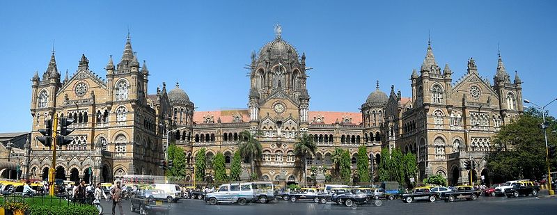
Victoria terminus in Mumbai is the first railway station in India.

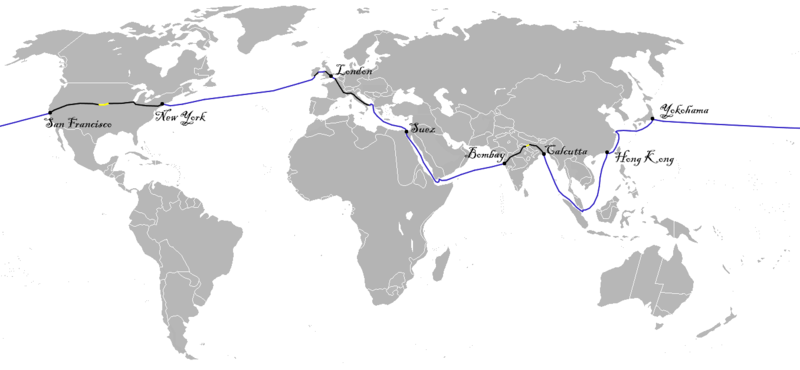
Robert Maitland Brereton, a British engineer, was responsible for the early expansion. It was Brereton’s work that linked Bombay to Calcutta, opened in March 1870, and was the inspiration for the French writer Jules Verne’s book Around the world in eighty days. Not sure my own virtual journey will be just eighty days, but I seem to be doing quite well so far.

This is the proposed route that Phileas Fogg took on his journey. Mostly by sea.

Posted in Enroute | Tagged , , | Leave a comment

Day 26: New Delhi

New Delhi? So what happened to Old Delhi?

The foundations for the new city were laid in 1911 to the south of the old city and the World Cities Study Group at Loughborough University rated New Delhi as an “alpha- world city” in the 2010 report. The old city is somewhat dilapidated and tired, but still forms the symbolic heart of the capital.

Delhi seems to be an extraordinarily popular location to stick a city. New Delhi is allegedly on the site of another seven or more ancient cities. That’s a lot of cultural history, and I’m not sure there are many other cities that can claim the same sort of lineage. The earliest finds date back to the Maurya period of around 300 BC, and the site has been under development ever since. That seems to outdate London history by around 200 years. In saying this, there doesn’t seem to be any actual archaeological proof, and the history is almost entirely anecdotal.

The ancient Indian text The Mahabharata is the first ever mention of the city and puts it at over 5000 years! I have a fascination with medieval illuminations and, as a former art student, I have had a go at producing some in the past. The work involved is measured in weeks, not hours, and didn’t go out and make my own paper. The most successful series on Indian TV is the Mahabharata. Take a look on YouTube.

It’s a warm 25c with no wind once I get into the streets, and very busy. The walk from the hotel takes me first past the Sarojni Nakar Market, which has a big selection of crafts, art and furniture.

There is so much colour about.

Shopping seems to be a national pastime.

I Google a few landmarks to see what I should visit on my virtual tour. New Delhi, like many other capital cities around the world have a huge stone monument called the India Gate. This is the ‘Arc de Triumph’, sort of thing that commemorates the losses during past wars, and the India Gate bears the names of over 13,000 British and Indian soldiers killed in the Northwestern frontier in the Afghan war of 1919. I carry on walking towards the river that lies beyond the main city plot in front of me.

The city stands on the bank of the river Yamuna, which starts out in the himalayas to the north east in neighbouring Nepal. The pollution of the river is so bad that the Indian Government has spent an enormous amount of money on the problem, but the pollution keeps rising. This work has mostly been in the development of new waste-treatment stations, but the real problem is the under efficiency of the sewage system.

I don’t go for a paddle. Instead I take a rickshaw to the Qutb Minar heading south and back to my hotel. I will stay over tonight and head out very early towards Dhangadhi and Nepal.

Posted in Places | Tagged | Leave a comment

Something about Kaithal

I drive in and out of Bakshiwala on the SH11 and head down the Kathal Road towards today’s destination of New Delhi. Of the three routes that Google maps has offered, I choose route 3. It’s not the shortest route, but it takes me through a town that has an interesting history.

Don't always take the quickest route.

imur, the emperor of the Mughal dynasty, and sought to restore the Mongol empire, stopped off here on his march to destroy Delhi in 1398.

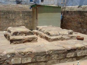
Kaithal claims to be the final resting place of Razia Sultana, the first woman ruler of India, reigning as the Sulatana of Delhi Sultanate from 1356 to 1240. Kaithal as the burial place is not confirmed, and it is also suggested that she is buried in Old Delhi. The Kaithal link goes like this. She fled Delhi after their defeat in 1240, reaching Kaithal the next day, where their remaining forces abandoned her. Falling into the hands of the Hindus, they were killed. True or not, it makes for a good, solid story. The more I read about her the more I wanted to believe this story, more than some of the others. With a reputation for being a good administrator and keeping the nobility in check, her armies were solidly behind her. Well, until they were losing!

Kaithal has a number of historic buildings, not least the ruined fortress. This must have been incredibly impressive to any visitor when these buildings were first erected. Having seen mud-built housing throughout these areas, this stood high and mighty.

Razia may lie here if the stories are to believed.

Kaithal fortress, Haryana.

I arrive in New Delhi at a reasonable time to get to my hotel. I used TripAdvisor for some recommendations, but found the hotel I wanted (Ibis Gurgaon) using expedia.com for £67. It’s not central, but does seem to be in a good place. So let’s get some sleep, and tomorrow I will spend the day sampling what New Delhi has to offer.

Posted in Enroute | Tagged , , , | Leave a comment

Following the Grand Trunk Road

I am on what is probably the most important route during the British Raj, the Great Trunk Road. I suspect it wasn’t always this good a drive. History proves that this northern highway has been in use since at least the 3rd Century BC. In the 16th Century, a road was built by the Pushtun emperor Sher Shah Suri, who ruled across northern India. This is largely considered the beginnings of the Great Trunk Road we see now.

Today, the Great Trunk Road is a collection of modern highways and A roads that span a distance of 2,500 km (1,600 mi) from Chittagong, southern Bangladesh, in the East to part of the Jalalabad-Kabul Road in Afghanistan in the west. As I head east, I am sure to meet it further along.

The Ambala cantonment during the British Raj.

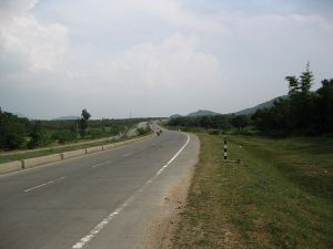
A modern highway through Barkatha.

Posted in Enroute | Tagged , , , , | Leave a comment

Ludhiana

I don’t get to Amritsar, the nearest town to the border worth going to, but the Google map route takes me off down the Atari road and on to Tarn Taran. The town was founded by the fifth Sikh Guru Shri Guru Arjan Dev Ji (1563 – 1606). To think that he was doing this while Shakespeare wrote and wandered around London.

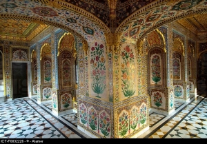
Gurudwara Tarn Taran Sahib

Can you imagine how long it took to decorate this?

About half way there I pass over the river and around the Harike Bird Sanctuary to my left. Despite the fact that local industries dump huge amounts of polluted water and chemicals into the river, this area has been given a high quality rating. Over 200 species of bird visit these waters during the winter season, such as the Yellow-crowned Woodpecker and the Indian Skimmer. I have to say, the waters do not look that clean, and the river is the cause of some major flooding every year.

I cross the river three times by the time I get to Ludhiana as I criss-cross around the Punjab district. Entering the city I notice that this is mostly industrial, but many of it’s central area has a rich history and many victorian buildings, including the well-known clock tower. I ‘book’ a room in the Maharaja Regency hotel near the centre for £62. This is not bad for the city, but I could have booked something for less, but hey, I’m on holiday!

Posted in Places | Tagged , , | Leave a comment

Crossing to India

The border is only open between about 08:30 and 15:00, and I am expecting it to take a few hours from one side to the other. This border is the only road border between Pakistan and India, and given the length of the border between these countries, I can hardly believe there is just one.

Google maps actually plots a course for me going south of Lahore through the closed border of Ganda Singh Wala. This border was considered for reopening in 2005, but was later dropped. I therefore picked route 3, which should take me about four hours, over the Sutlej river, and on to Ludhiana. Considering how long it is likely to take to get through the border system, I doubt I will get much further today.

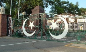
Across the only land border crossing to India

Wagah was the original village that the famous Radcliffe Line was drawn through. On July 15, 1947, the Indian Independence Act 1947 of the Parliament of the United Kingdom stipulated that British rule in India would come to an end just one month later, on August 15, 1947. The Act also stipulated the partition of the Provinces of British India into two new sovereign dominions: the Union of India and the Dominion of Pakistan. Separating the areas was a brave move, especially considering that the two countries were made up of many tribes. The British Government took this separation work upon itself with no outside help, despite the existence of the United Nations, which was set up in 1945, as a replacement of the League of Nations. It wouldn’t have been the British thing to be seen needing help to make changes to its own empire. These changes cut Wagah in two.

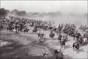
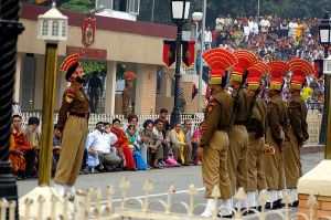
I am making a point of missing the closing ceremony that is held at the end of each day. The ceremony is a tradition that has run for years and years, and Sunday is just about the worst day to see it.

East Wagah to West Wagah.

Lots of bluster and quite a spectacle.

Previous travellers have had a mixed bag of experience getting through Wagah. Most seem to go through on the scheduled bus or train, which can make it much simpler a process. My virtual self, in the camper, will be a little slower. I will need a visa to cross, and if I were to want to go back into Pakistan, that seems to involve another visa, but is much harder to arrange. Anyway, I queue up and wait my turn. The guards pass you to another guard, and then to another. Each one checks your passport and papers. I am asked to get out of the camper. Asked to get back in and move to the next guard. I read a terrific blog by someone who was put through a few hours of grief, along with visiting family for no apparent reason, but that the guards could do as they pleased. I would like to think that if I kept my mouth shut and nodded when addressed, I could be in India in no time.

Posted in Enroute | Tagged , , , | Leave a comment