Day 43: Across the Friendship bridge

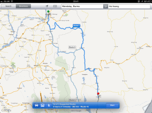
After leaving Thaton, the drive to the Thai border crossing took me along Highway 85 and over the Thanlwin bridge at Hpa An. It takes about two and a half hours to get to the border, and I pull over just short to make sure everything is in order.

In reality, this is currently only passable from Thailand to Burma. Up until very recently the Friendship bridge would only allow crossing by foot, despite being a two lane highway on stilts, and your visa would only allow you a day’s worth of time on the Burmese side. The bridge is closed often, mostly due to the trouble on the Burmese side with the Karen National Liberation Army (KNLA). Like the Moreh crossing in the north, I would not be allowed to do the crossing I am about to do. From the Thai side, there is no visa required, only an entry stamp which you would pay US$10, if paid for in dollars, but more (about 500 baht) if paid in Thai currency. None-negotiable.I have to say, I have found that the US dollar is good in most places. Mae Sai/Tachileic, in the north is open daily, but obviously quite a way from Bangkok or this region.

When I started to plot my route through Thailand, I did contemplate going through the northern crossing, but there was something about Burma that I needed to sample. Besides, it would have then made sense to miss Bangkok and cut straight across into Laos. And where’s the fun in that?

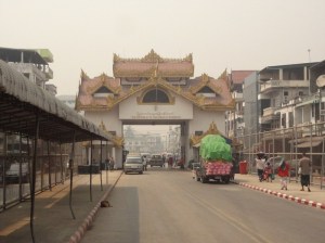
So here I am, negotiating the line of people wandering along the road that connects to the bridge. The Friendship Bridge was completed in 1997. Another bridge is planned on the same river.

A look back as I cross the bridge.

The checkpoint on the other side.

Passing through Mae Sot, I join the AH1, which is part of the Asian Highway Network. I have driven parts of this road connection through Turkey, Iran, Pakistan, India, Bangladesh and Burma, and now Thailand. Not all of this long Highway is open all of the time, and the Burma section is obviously limited. I fill up the tank at one of the big petrol stations and pick up some food from the side market. It’s suddenly great to see familiar products on the shelves. And proper shops for that matter. It’s about four hours to my next stop, so let’s get going and I’ll fill you in on the way.

Posted in Enroute | Tagged , | Leave a comment

Touching the Thai border

The first part of my drive today is down Highway 5 along the eastern edge of the Karen Hills. I am starting to find the odd person who is willing to try their English on me, and find out that Burmese TV has English lesson programmes. Burma became independent from Great Britain in 1948 and most colonial ways have been eradicated by the military government. Since then it has had a turbulent existance and only in recent years as it started to find its way out. Each election introduces a little more freedom for the Burmese people, and Aung San Suu Kyi, the Burmese opposition politician, has introduced a possible way forward to democracy within Burma. We will see.

After about three and a half hours I pass Kemapyu and change onto National Road 85, still going south. Google maps tells me that I am now passing between the Thai border to the east and the jungle village of Dutado to the west. Dutado became a news headline in 2010 when the Burmese army attacked the village, forcing the villagers into the jungle in little more than the clothes they were wearing. The village was burnt to the ground and people shot. More than 3,600 villages have been destroyed in Eastern Burma in the past 15 years, an average of four every week. It’s difficult to think that such extremes still happen in the 21st Century, but they do. The Karen National Liberation Army is fighting this area of Burma in a battle for more freedom, but certainly not the only front against the Military rule. Burma is not the only country that conducts itself in this way, but as I drive through in my virtual tour, I have learnt good and bad things, and I feel lucky to live in a largely free society.

I arrive at Hpapun, having taken a path along a very long valley, and take Highway 8 to the west and then south. One interesting thing I notice is the number of airstrips I pass on the way down. I can find that a lot of them were airfields laid down during the Second World War by the Japanese army. The majority now seem to be left to ruin. At Bilin I take the NH 8 on to Thaton, where I will be stopping over tonight.

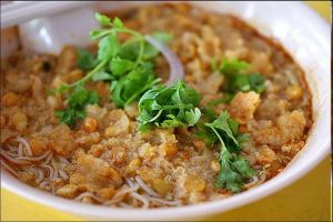
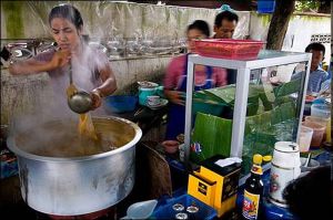
Thaton was the capital of the Thaton Kingdom between the 9th and 11th centuries. Thaton was once a thriving seaport, trading with India and Sri Lanka. Heavy silting has now rendered the coastline some 16km away and the town is now quite. Its rail connection is not its main link to its surrounding country. I am early enough to find an open store selling cooked food in large metal woks. The food is both colourful and rish in flavour and I choose an aromatic rice dish. This is widely considered the Burmese national dish.

Mohinga dish

A traditional Mohinga street shop

I couldn’t leave Burma without sampling this lively dish. (although I am told that it is normally a breakfast meal, but I prefer something less spicy) I then retire to my camper for the night for a good rest. Tomorrow, I head east across the border into Thailand.

Posted in Enroute | Tagged , , | Leave a comment

Seeing the wood for the trees

As I head south towards Hsi Hseng I get to sample a little local village life in the small, forest settlements. Firstly, nobody speaks English here, and none of the road signs have anything but Burmese on them, which I don’t know. I have to cross the mountains and the roads are adequate, but gravel-based, which is a little slower than I would like. It’s funny. When I move onto asphalt road, or more often in this area, concrete, I can put my foot down a little, which is good for the soul. Don’t expect to get anywhere quickly coming this way, as the roads are often little more than single file earth or gravel tracks.

A rich landscape in so many ways

After about an hour or so I drive past Gwebin, a village off the mountain track, which has the rather impressive name of Highway 311, but it’s not much more than a country lane in most parts. This area is well known for its ruby and sapphire mining, and there are signs of this all over the place. Gwebin had a moment of fame in 1929, when a sapphire was discovered by a group of labourers weighing in at 958 carats. It was later sold to a New York dealer for $13,000. That’s a kings ransom in these parts. Like all of the villages in this area of Burma, it was occupied by the Japanese army during the Second World War.

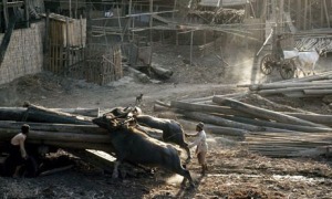
Burma has a very successful forestry export business and supplies 80% of the world’s teak. There are major concerns in the shear amount of deforestation that is going on in this country.

Once over the mountains I drop down and along the range to my right. A winding road takes me right through the village of Indaw, which sits on the side of the Indaw lake. The houses are neatly arranged and more modern than I would have expected. Indaw had two airfields during the Second World War, but only one seems to be here now. Indaw was the scene of one of the decisive battles between Japanese and British forces during 1944. The Japanese had developed the two airstrips, one in its current place and one on the shore of the lake, and used it to stage attacks in the area. During 1944, the Long Range Penetration groups of the British army, trained to cause maximum disruption to the invading army, attacked Indaw on March 26th, but were met by 2,000 Japanese troops all dug in and waiting for them. 9,000 troops were dropped into north Burma, and played a decisive action in pushing the advancing Japanese army back.

By the time I arrived in Hsi Hseng, I was hot and tired. It is not as humid as I thought it would be, but a temperature of around 27c. I am promised a cooler night tonight of about 11c.

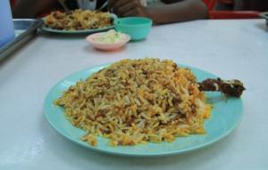
I go to an open food store and choose two dishes I like the look of. One if Vada, a lentil doughnut and looks like a really nice meal in itself. The second is a biryani called ‘dan pauk’. Biryani is to the Burmese what a cheeseburger is to Americans, so I have to try it.

Lentil doughtnut, Vada

The Burma Biryani. A must!

Posted in Enroute | Tagged , | Leave a comment

Looking at Mandalay

Rudyard Kipling wrote the famous Mandalay poem in 1890. His father was a museum curator and you may remember this from my visit to Lahore a few weeks ago. Kipling was born in Bombay in 1865 and became a journalist and writer. His most famous offering was The Jungle Book, published in 1894.

I had arrived in Mandalay at a good time and considered trying the next staged route Google maps gave me, but some of the roads are not really up to it, and I can’t guarantee getting the distance. Sunset is about six, and its not great arriving somewhere in the dark. I therefore find a nice spot off the road and decide to stop over and take a look at Mandalay for the afternoon.

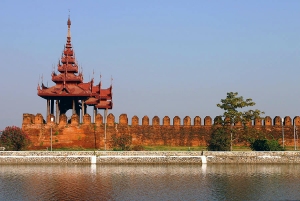
Mandalay fort

Sacred hill

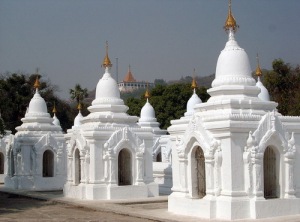
The city is almost exactly central in Burma, and sits to the east of the Irrawaddy river. The area is on the Sagaing Fault, which had its last major earthquake in 1956. Mandalay is central to the Buddhist religion and has over 700 pagodas. Kuthodaw Pagoda was built by King Mindon in 1857, this pagoda modeled on the Shwezigon Pagoda at Nyaung U, is surrounded by 729 upright stone slabs on which are inscribed the entire Buddhist Scriptures as edited and approved by the Fifth Buddhist Synod. It is popularly known as “the World’s Biggest Book” for its stone scriptures.

Kuthodaw pagoda

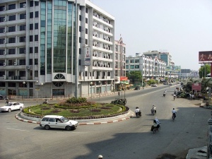
A modern Mandalay city centre

After a good walk around, I retire to the camper and have a simple meal of flatbread, rice and fruit. Tomorrow I will head further south.

Posted in Places | Leave a comment

Day 40: Road to Mandalay

Once east of Kalewa, I drive along the main road that takes me over the hills and into the open lowland that takes me onto Mandalay. This is pretty much thick forest all the way. I am mindful of the fact that as a British citizen, I would have no chance of really doing this drive without ending up in a Burmese prison. I found that I could enter Moreh and travel the short distance to Tamu, just across the border, but the rules are that I would have to go straight back across the border at the end of the day. No stay over. No hotel. For this reason, I will be sleeping in the Camper wherever I get as a symbol of defiance.

Just a couple of hours drive through the thick jungle, which is pretty humid, I pass through Shwebo, also known as Ratanasingha, and was the capital of Burma between 1752 to 1760. Not the biggest capital city I have known, but the ancient moat that surrounds the town is worth seeing. Very few tourists make it this way, not least because of Burma’s restrictive laws and military rule.

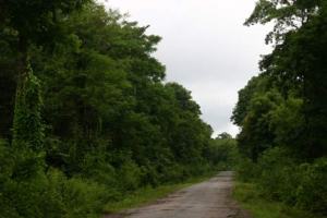
Playing i-spy is a waste of time.

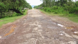
The monsoon season leaves its mark.

Burma shares a border with India, Bangladesh, China, Laos and Thailand and has a population of around 60 million people. In 1287 the country was invaded by the Mongol nation and the Pagan rulers fell. Burma was later reunited by the Taungoo dynasty, which for a while became the biggest empire in Southeast Asia. In the 19th Century, after a number of Anglo-Burmese wars, it was colonised by the British Empire.

Burma is also known as Myanmar, but due to the United Nations and several other organisations imposing sanctions on the country for human rights violations, the military government is not recognised by many countries, including United Kingdom, United States, Australia and Canada.

Posted in Enroute | Tagged , | Leave a comment

Crossing at Moreh

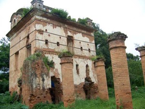
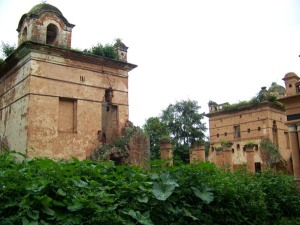
Before I checked out of the hotel, I walked across the road to see the fort, nestled in the large park opposite. Kangla was the original ancient city where Imphal now stands and was the capital until Imphal took over in 1891. Kangla palace was home to King Pakhangba around 33 AD, and is now more ruin that stately home. It stands in a park with its own moat that runs most of the way round. The land is partly landscaped, but a few areas are overgrown and pretty much derelict.

I head out on the Imphal-Moreh Road or Highway 102 towards the hills. Before I get there, I have to say that Moreh has a bit of a reputation. Not only is it a well-known crossing for smugglers, but is happens to be a centre of the heroin trade. Well, that and amphetamines and a selection of other things to boot. Last year a big timber smuggling ring was busted here, so the contraband can take almost any form.

The roads are easily navigated, but a line of very large trucks passes me and this seems to be quite commercial. The mountains are not so high in the first stretch, and I soon approach the border crossing down a straight road. There is quite a queue, so I pull over and eat something while I wait. While there have been travellers crossing into Burma from India with their own vehicles, the general consensus seems to be that it is very hard. Permits can be organized from your own country in most cases, but international restrictions on Burma makes it all a bit of a problem. Either way, an Indian permit will be needed to go through Manipur, and an MTT permit will be required to get to Tamu. Some people report that a permit to get from Tamu to Kalewa, where I’m going, is needed, but I couldn’t confirm that.

An hour goes by and I move slowly up. I hand my papers to one of the guards and I am moved forward through the arch and into a large open square. There are some shops around one side, but I don’t stop. The main road takes me off into Burma and I eventually find the road south towards Kalewa. Less than half an hour south I pass through Khomunnom, a small village and home to the Khomunnom cave. Various kinds of Paleolithic tools for cutting and polishing were found and collected. These tools were used during the lower Paleolithic Era and probable culture of 200,000-50,000 BC. This Cave is one of the oldest and biggest rock shelters in the world.

Google maps suggests a drive of just over four hours, but the roads are not perfect and my camper does a steady fifty miles an hour. I pass by the Myit Thar bridge and into Kalewa. It’s a low, unassuming town much larger than I thought, and the river Myittha makes for an idyllic view. I will find a place to park up and spend the night in the camper. Tomorrow, I will head south to Mandalay.

Posted in Enroute | Leave a comment

Into Imphal

The drive around the last mountain ridge, which takes me as high as 1300 ft before heading down the winding hillside. Despite the drop down the mountain road into the spectacular plain, Imphal is still at a height of 800 m and sits in a bowl shaped plain between a ring of mountains.

Imphal is a city of many histories. Among the tribes that inhabit the Manipur region, the Meiteis, or Meeteis are the majority ethnic people and are often referred to as the Manipuris. The Meities can trace their tribal history back to around 33 AD. The region has a rich history and colourful festivals, with fabulous displays of their culture and handicrafts and the people of Imphal are naturally creative. The famous Rasa Lila is considered to be the epitome of the classical dance of Manipur and this dance shows the eternal love of Radha and Krishna. It is generally performed in Mandop on Kartik Purnima, Sarada Purnima and Basanta Purnima nights. Most of the Rasa Lila dances are performed at Shri Govindaji Temple of Imphal.

The area has seen many bloody battles and invasion forces from the Burmese in the east. The most famous conflict is the Battle of Imphal in 1944. Faced with the invading Japanese army, the city was the scene of a furious battle. By 1944, the Japanese army were facing defeat in a number Pacific locations, including Burma. Advancing on the Manipur region in order to invade India, they were held off by Indian and British forces.

I have ‘booked’ my virtual self into the Classic Hotel facing the park. It has secure parking and a snip at £47 for a standard suite. Always remember the taxes they don’t tell you about. I will try a restaurant in the area and get a good night’s sleep. Burma tomorrow!

Posted in Places | Tagged , | Leave a comment

Sub-Himalayan Manipur Hills

Before I leave this morning, I find that I am 11,000 miles from home. Google maps tells me that it would take about five days and 20 hours if I headed back now. This does, of course, assume that I will be doing the state speed limits and didn’t stop much [Or at all!], but my lovely camper is too nice to trash.

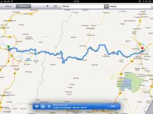
Instead, and in the true spirit of the journey, I leave Silchar just before 10:00 and head out of the top of the city and onto the NH53 east to Imphal. I fill up the tank, buy some fresh fruit for the drive and head off. After a few twists and turns, I realise that there are mountains ahead.

It's a bit hilly around here.

I roughly follow the winding Borek river that I crossed yesterday. At Lakhipur I stop and watch the ferry head across the river. This is a small, but busy town and a number of ferries move all sorts of things from one side to the other.

As I head up into the Manipur hills, the roads become more gravel-based. It’s noticeably cooler up here. The hill region is classed as a sub-himalayan range and forms a very neat ring around the capital city, Imphal. The highest in the range is over 12,000 ft. (Approx. 3,600 m.) As I head up the road, I am already in the lush forest that line the mountains. Most of the road is at an elevation of 500 to 700m, and the sharp ridges are paired with steep drops on many sides. I wind around the peaks and meet the occasional river. It’s dry today, and I am happy with that, given that the roads are nothing more than open gravel and the occasional steep drop-away. This time of year tends to be largely dry, with May/June being the hottest months. I meet a number of military convoys along the road and let them pass. The area has quite a story to tell.

The game polo originated in Manipur. British soldiers and planters took it back to England, changed the rules a little and made it popular around the world.

Posted in Enroute | Leave a comment

Day 37: Skipping along borders

Today, Google maps has plotted a route back into the Assam region of northern India and then east towards Silchar and the Burmese border. The nearest actual border crossing I can see is Dawki/Tamabil, north of Sylhet. The crossing it actually takes me on is an unknown entity, and I can’t actually find anything on this place. Still, my virtual self drives across and up the hill road into the cachar hills. I only rise about 200 ft, but the views here are fantastic. Everything is so green.

The Assam region was developed extensively in the mid to late 1800′s. The British allowed the rental of land plots, mostly to the north of where I am, which made it possible for private business to develop the modern teas we have now. Assam is so green throughout the year, it is often described as the most beautiful place in India, maybe only second to Kashmir.

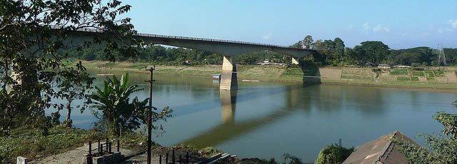
I take the NH44 south and then east to Silchar. I cross the very modern looking Badarpur bridge over the Borak river.

Despite the short trip through the hills, I arrive at Silchar much quicker than I expected, but decide to find a friendly place to eat. I am told that I can park at the cricket stadium, which is a little further on. I thought they were kidding, but lo and behold there is a stadium. A young man on a moped took me there and said I should give the guard some money, which I did. It was obvious that my guide expected something too, so I obliged with another handful of money. He seemed pretty happy and rode off.

I will sleep in the camper tonight. I have plenty to eat this evening, but there is a cinema a short walk away and I might, if I am brave enough, see what’s on. Not sure if the patrons will watch the film or me. Maybe I’ll just stay here.

Posted in Enroute | Tagged , , | 1 Comment

Farming and livestock

As I head north I watch the land roll by. Small herds of cattle stand waiting and the fields are being prepared for the spring. People work hard here, that’s for sure. I pass a group of women carrying large bundles along the roadside and even the children do their part. Like other river deltas, Bangladesh is a very fertile place.

There are no rocks, stones, boulders or pebbles. No sandy beaches. It’s all silt and mud washed down from the Himalayan mountains over millions of years. Most people farm. Though I see people farming every day, I haven’t seen a tractor. But I am also aware that there is hard work for little return, and I get that some, if not all, of these people are struggling. In Chandura, about half way to my destination of Sylhet, the river flows to my left and I watch a number of small boats going about their business. Fishing is a bit thing, and supplies most of their protein, and the throw nets are so skillfully.

It’s pretty hot today, and the gauge in the camper tells me it’s 32c. I don’t need a dial to tell me that it’s also very humid. I occasionally get stuck behind a slow moving cart and the owner is often friendly enough to let me by, but not always. Some parts of the road are quite narrow. I arrive in Sylhet a little later than expected. Some of the roads are less navigable than others, and the Bangladeshi people, especially the children, have found my appearance to be very distracting. They do like to come up and stare at you, or prod in some cases. A young boy, who started out trying to sell me a bowl, ended up just holding onto my shirt tails as I bought some fruit and vegetables in his town. OK, I bought the bowl!

I dodge rickshaws all the way in on the main road. I am ‘booked’ in at the Hotel Dallas in an economy room that costs just BDT 400 (About $10) For that I get a much more reasonable room than I anticipated. I thought I would get a cupboard in someone else’s room!

Posted in Enroute | Leave a comment